The Warrin Team | San Francisco + Marin County
Best Parks in
San Francisco, CA
Eight parks covering Golden Gate Park, the Presidio, Dolores Park, Lands End, Alamo Square, Crissy Field, McLaren Park, and the Embarcadero waterfront -- with acreage, trail detail, and the neighborhoods each one anchors.
Direct Information Summary Layer
What are the absolute Best Parks in San Francisco?
The **best parks in San Francisco, CA** are headlined by **Golden Gate Park**, a sprawling 1,017-acre municipal masterwork housing top cultural museums, and **The Presidio**, a magnificent 1,491-acre coastal preserve framing direct bridge lookouts. Relocating families and outdoor walkers systematically favor exploring the panoramic cliffs of **Lands End**, the downtown city vistas of **Mission Dolores Park**, and the waterfront running corridors along **Crissy Field**.
Best Parks in San Francisco: Quick-Take
- Largest park: Golden Gate Park -- 1,017 acres, 7.5 miles long, free entry; de Young Museum and California Academy of Sciences on-site
- Best coastal park: The Presidio -- 1,491 acres of former military land, Golden Gate Bridge views, Crissy Field beach, free entry
- Best city views: Dolores Park (Mission District skyline) or Alamo Square (Painted Ladies backdrop)
- Best dramatic scenery: Lands End -- Coastal Trail, Sutro Baths ruins, unobstructed Golden Gate views, 3.4-mile trail loop
- Best for families: Golden Gate Park -- playgrounds, carousel, Bison Paddock, paddle boats on Stow Lake
- Best waterfront: Crissy Field -- restored tidal marsh, flat paved path, direct Golden Gate views, dog-friendly
- Largest undiscovered park: McLaren Park -- 317 acres, 7 miles of trails, significantly less crowded than Golden Gate Park
- Entry fees: Nearly all SF parks are free; Golden Gate Park attractions (de Young, Academy of Sciences) charge separately
San Francisco Parks at a Glance
Park Asset | Acreage Size | Best Known For | Nearby Sub-Market Neighborhoods | Entry Parameters |
|---|---|---|---|---|
Golden Gate Park | 1,017 acres | de Young, Academy of Sciences, Stow Lake, Japanese Tea Garden | Richmond, Inner Sunset, Haight-Ashbury | Free (attractions extra) |
The Presidio | 1,491 acres | Golden Gate Bridge views, Crissy Field, historic military architecture | Presidio Heights, Sea Cliff, Marina | Free |
Dolores Park | 16 acres | Downtown skyline views, weekend social scene, tennis and playground | Mission District, Noe Valley, Dolores Heights | Free |
Lands End | ~200 acres | Coastal Trail, Sutro Baths ruins, unobstructed Golden Gate views | Outer Richmond, Sea Cliff | Free |
Alamo Square | 12.7 acres | Painted Ladies Victorian row, downtown skyline backdrop | Western Addition, Hayes Valley, NoPa | Free |
Crissy Field | 100 acres | Restored tidal marsh, flat waterfront path, direct Golden Gate views | Marina District, Presidio Heights | Free |
McLaren Park | 317 acres | 7 miles of trails, Philosopher's Way loop, significantly uncrowded | Excelsior, Visitacion Valley, Outer Mission | Free |
Embarcadero / Ferry Building | Linear waterfront | Bay views, Saturday farmers market, waterfront cycling and running | Financial District, South Beach, Jackson Square | Free |
San Francisco Regional Park Profiles
01. Golden Gate Park
At 1,017 acres and 7.5 miles long, Golden Gate Park is one of the largest urban parks in the United States and the defining green space of San Francisco. It stretches from the Haight-Ashbury neighborhood west to the Pacific Ocean at Ocean Beach, and its scale means that different sections function almost as separate parks for different user groups.
What to Know Before You Go
- de Young Museum -- fine arts museum with rotating international exhibitions and a rooftop observation deck with 360-degree city views; admission charged, free first Tuesday of each month
- California Academy of Sciences -- natural history museum, planetarium, and living roof under one structure; one of the most visited science museums on the West Coast
- Japanese Tea Garden -- the oldest public Japanese garden in the United States, established 1894; small entry fee applies
- Stow Lake -- 11-acre lake at the park's center with paddle boat and rowboat rentals, a waterfall, and Strawberry Hill island; popular with families
- Bison Paddock -- a herd of American bison has lived in the park's western section since 1899; free to view from the perimeter path
- Cycling and roller skating -- JFK Promenade is closed to cars and runs the park's length; bike rentals available near the Haight-Ashbury entrance
The neighborhoods bordering Golden Gate Park -- Inner Richmond, Outer Richmond, Inner Sunset, and Outer Sunset -- are among San Francisco's most sought-after for buyers who prioritize park access as a daily lifestyle feature rather than an occasional destination. Edwardian and Craftsman homes along Fulton Street to the north and Lincoln Way to the south routinely attract premium pricing relative to comparable properties a few blocks farther from the park boundary.
02. The Presidio
At 1,491 acres, the Presidio of San Francisco is actually larger than Golden Gate Park, though it receives fewer visitors due to its position at the northwestern tip of the peninsula. A former U.S. Army base transferred to the National Park Service in 1994, it combines historic military architecture, old-growth forest, coastal bluffs, and direct access to the Golden Gate Bridge in a configuration that does not exist anywhere else in a major American city.
What to Know Before You Go
- Crissy Field -- restored tidal marsh and waterfront promenade with flat paved path running 1.5 miles along the bay; direct views of the Golden Gate Bridge; dog-friendly and highly accessible
- Battery to Bluffs Trail -- 3.2-mile loop through coastal scrub and past historic gun batteries; considered one of the best urban hiking trails in Northern California
- Golden Gate Bridge access -- the Presidio provides the most direct pedestrian and cyclist access to the bridge's south tower and the Vista Point overlook
- Tunnel Tops -- opened 2022, a 14-acre park built above the Presidio's former highway tunnel, with playground, lawn, and firepit areas; the newest addition to the park
- Lucasfilm / Letterman Digital Arts Center -- located within the Presidio grounds; the campus is not publicly accessible but the surrounding park and Yoda Fountain are
- Historic Officers' Club -- the oldest building in San Francisco, dating to the Spanish colonial period; houses rotating museum exhibitions, free admission
03. Mission Dolores Park
Dolores Park occupies 16 acres at the edge of the Mission District and Noe Valley, and it functions as San Francisco's most active neighborhood park -- the difference between a destination and a backyard. On weekday mornings it is quiet and practical; on weekend afternoons it holds more people per acre than almost any other public space in the city. The eastern slope faces downtown and on clear days frames the Financial District skyline against blue sky, making it the most photographed park interior view in San Francisco.
What to Know Before You Go
- Downtown skyline view -- the eastern slope offers an unobstructed view of downtown San Francisco with the Bay Bridge visible on clear days
- Tennis and pickleball courts -- six courts, reservable online through SF Rec and Parks; popular enough that weekend waits are common without a reservation
- Playground and dog play areas -- separate off-leash dog area in the southwest corner; renovated children's playground near the Church Street entrance
- Bi-Rite Creamery -- the park's most famous adjacent business, with lines routinely extending to the sidewalk on weekends; the cheese shop and general store are across the street
- Weekend crowds -- Dolores Park is genuinely packed on sunny weekend afternoons from March through October; arrive before 11am for a reasonable spot on the slope
04. Lands End and Sutro Baths
Lands End is the northwestern corner of San Francisco where the city ends and the Pacific Ocean begins. It is the most dramatically positioned park in the city -- the Coastal Trail follows bluffs above the water with unobstructed views of the Golden Gate Bridge and the Marin Headlands across the channel. The ruins of the Sutro Baths, a Victorian-era public bathhouse that burned in 1966, sit at the base of the cliffs and fill with the tide, creating one of San Francisco's most distinctive and photographed landscapes.
What to Know Before You Go
- Coastal Trail -- 3.4-mile out-and-back or loop route along cliff-top bluffs; the section between the Sutro Baths and Eagle's Point Overlook offers the most dramatic Golden Gate Bridge views in the city
- Sutro Baths ruins -- free to access; built in 1896 as the world's largest indoor swimming pool complex; the ruins and tide pools are accessible via a short trail from the Lands End Lookout visitor center
- Lands End Lookout -- NPS visitor center with cafe, restrooms, and exhibits on the park's history; the closest parking to the trailhead
- Labyrinth -- a stone labyrinth on a rocky outcrop overlooking the ocean, maintained informally by park visitors; one of the more unexpected discoveries in the park
- Wind and fog -- Lands End is reliably windier and foggier than the rest of the city; layers are essential even in summer
05. Alamo Square
Alamo Square is a 12.7-acre hilltop park best known for the view from its eastern slope: the "Painted Ladies" -- a row of six Victorian houses on Steiner Street with the downtown San Francisco skyline rising behind them. This is one of the most reproduced urban photographs in the United States. The park itself is a functional neighborhood green space with a dog play area, children's playground, and picnic lawn, but its primary draw is the view and the architectural context surrounding it.
What to Know Before You Go
- Painted Ladies viewpoint -- the classic view is from the benches on the eastern slope, facing the row of Victorians on Steiner Street; arrive early morning for the best light and fewest other visitors
- Postcard Row -- the six Queen Anne Victorians on Steiner Street between Hayes and Grove were built in 1892-1896; they are privately owned residences and not open to the public
- Hilltop views -- the park's highest point offers panoramic views of the downtown skyline, the Bay Bridge, and on clear days, the East Bay hills
- Hayes Valley proximity -- the neighborhood immediately east of the park is Hayes Valley, one of San Francisco's most active dining and retail corridors
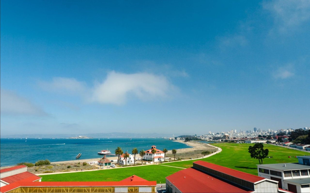
06. Crissy Field
Crissy Field is a 100-acre waterfront area within the Presidio that was restored from a paved airfield to a tidal marsh and beach between 1999 and 2001. The restoration project is widely cited as one of the most successful urban ecological restoration efforts in the United States. The result is a flat, accessible waterfront path with direct, unobstructed views of the Golden Gate Bridge along its entire length -- effectively the most consistent view of the bridge available from any public space in the city.
What to Know Before You Go
- Waterfront promenade -- 1.5-mile flat paved path from the St. Francis Yacht Club to Fort Point, dog-friendly and accessible for strollers and cyclists
- Restored tidal marsh -- 20 acres of restored wetland habitat visible from the path; shorebird habitat and seasonal wildflower meadows
- East Beach -- a sandy beach at the eastern end of Crissy Field; swimming is not recommended due to currents, but the beach is used for kite flying and bay access
- The Warming Hut -- cafe and bookstore at the western end of Crissy Field near Fort Point; open daily, one of the few food options within the Presidio proper
- Fort Point -- a Civil War-era fort built into the south anchorage of the Golden Gate Bridge; free NPS site with views directly beneath the bridge span
07. McLaren Park
At 317 acres, McLaren Park is San Francisco's second largest park after Golden Gate Park, and it is the city's least-known major green space. Located in the Excelsior and Visitacion Valley neighborhoods in the southern part of the city, it receives a fraction of Golden Gate Park's visitors despite offering 7 miles of trails, a 55-acre reservoir, sports fields, and significant old-growth Eucalyptus canopy. For buyers prioritizing trail access without crowd density, McLaren is a meaningful consideration.
What to Know Before You Go
- Philosopher's Way -- a 2.7-mile interpretive trail loop through the park's core with benches, native plant restoration areas, and hilltop views of the bay
- Jerry Garcia Amphitheater -- an outdoor amphitheater in the park's eastern section hosting free summer concerts
- Largest undiscovered SF park -- on most weekend mornings, you can complete a full trail loop and encounter fewer than a dozen other hikers
08. The Embarcadero Waterfront
The Embarcadero is San Francisco's waterfront promenade running from AT&T Park (now Oracle Park) in the south to Fisherman's Wharf in the north -- approximately 3 miles of continuous bay-front public space. The Ferry Building at its center serves as both a working ferry terminal and one of the best food markets in Northern California, with permanent vendors and a Saturday farmers market that operates year-round. The Embarcadero is not a park in the traditional sense but functions as the primary waterfront green space and walking corridor for the Financial District, South Beach, and Jackson Square neighborhoods.
What Park Access Is Actually Worth in San Francisco Real Estate
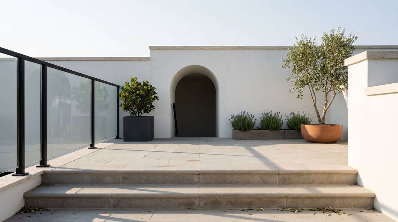
Park proximity is one of the most durable price premiums in San Francisco real estate -- not because buyers talk about it as a feature, but because it structures daily life in ways that are difficult to replicate by other means. A home on Fulton Street facing Golden Gate Park, or on Washington Street with direct Presidio access, provides a quality of daily outdoor experience that no amenity package inside a building can substitute for.
The premium varies significantly by park, by block, and by the specific view and access the property offers. A home on the north edge of Dolores Park commands a different premium than one two blocks south. A Sea Cliff property with Lands End trail access is priced differently from an Outer Richmond property four blocks from the same trailhead.
Explore Surrounding Local Real Estate Guides
Expand your spatial knowledge of the Northern California markets by accessing our local property and area blueprints:
San Francisco Parks: Common Questions
What are the best parks in San Francisco?
The most visited and well-regarded parks in San Francisco are Golden Gate Park (1,017 acres, museums, Stow Lake), the Presidio (1,491 acres, Golden Gate Bridge access, Crissy Field), Dolores Park (Mission District, downtown skyline views), and Lands End (Coastal Trail, Sutro Baths ruins). For locals, Crissy Field, Alamo Square, and McLaren Park round out the essential list. Nearly all are free to enter.
How big is Golden Gate Park in San Francisco?
Golden Gate Park is 1,017 acres and approximately 7.5 miles long, running from the Haight-Ashbury neighborhood west to the Pacific Ocean. It is larger than Central Park in New York City. The park contains the de Young Museum, the California Academy of Sciences, the Japanese Tea Garden, Stow Lake, a bison paddock, a carousel, and miles of cycling and walking paths.
Is the Presidio free to visit?
Yes. The Presidio is free to enter and operated by the National Park Service as part of the Golden Gate National Recreation Area. Parking in the Presidio is also free. Crissy Field, the Coastal Trail, Battery Bluffs trail, Tunnel Tops park, and the historic Officers' Club museum are all free. The only charges are at specific restaurants or private facilities within the park.
Where are the Painted Ladies in San Francisco?
The Painted Ladies are located on Steiner Street between Hayes and Grove Streets in the Western Addition neighborhood, directly facing Alamo Square Park. The classic view of the six Victorian houses with the downtown San Francisco skyline behind them is photographed from the eastern slope of Alamo Square. The houses are private residences and are not open to visitors. Alamo Square Park is free to access and open daily.
What is there to do at Lands End in San Francisco?
Lands End offers the 3.4-mile Coastal Trail along cliff-top bluffs with unobstructed Golden Gate Bridge views, the Sutro Baths ruins (a Victorian-era bathhouse that burned in 1966, now a free NPS site with accessible tide pools), a stone labyrinth on a rocky ocean outcrop, and the Lands End Lookout visitor center with a cafe and restrooms. The area is free to access and operated by the National Park Service.
Which San Francisco neighborhoods are closest to parks?
Inner Richmond and Inner Sunset border Golden Gate Park directly on its north and south edges. Sea Cliff and Presidio Heights border both the Presidio and Lands End. Marina District is adjacent to Crissy Field. Noe Valley and Mission District surround Dolores Park. Western Addition and NoPa are walkable to Alamo Square. Each of these park-adjacent neighborhoods commands a price premium relative to comparable properties farther from park access.
Find Your Parkside Address
From Presidio Heights estates to Dolores Park Victorians, The Warrin Team helps buyers find properties where park access is a daily structural advantage -- not an occasional amenity. Request a real-time comparative market analysis from our local luxury specialists.